|
Topic addressed Blue Economy Educational objective This activity will allow students to learn how to use geographical coordinates to find any specific location on a map and to gain knowledge about economic activities related to the ocean, seas and coasts. Age group 12 to 15 Language English Competences developed with the exercise Advanced use of digital maps, digital literacy, geographic information analysis, search for information |
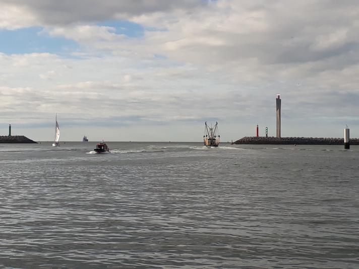
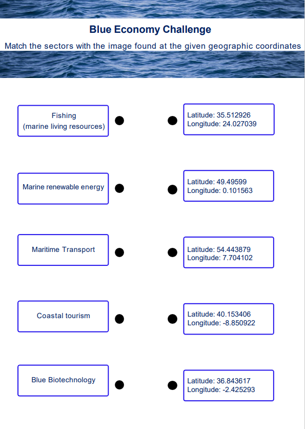
The Atlas team has hidden five images related to sectors of the Blue Economy in the European Maritime Day in My Country 2024 map layer! To help you, they have revealed the geographical coordinates of the locations where they are hidden. Can you find them? Connect the geographic coordinates of the images you have found with the different sectors in the document below.
Need some help? Watch the video tutorial on the Atlas’ measure tool to see how you can find a location using the geographical coordinates. Remember, you can zoom in the map by clicking on the + sign in the top right-hand corner of the screen or by scrolling.
 |
|
1) What are the nearest events to each location where you have found an image? What are the titles of these events?
2) The image for the marine renewable energy sector is located in the sea. Combine the map layers ‘European Maritime Day in My Country 2024 ’ and ‘Wind farm locations (polygons)’ to see that the image is hidden at a location of wind farms. Are these wind farms planned or in production?
3) The current basemap is the ‘EMODnet template’. Change the basemap to the ‘Cities template’. What is the closest city to the location where you have found the image for coastal tourism?
4) Open the map layer related to fisheries that present data on Catches by country. Looking at the map, can you indicate which are the top three countries with the highest catches? Click on one of these countries to see how catches have evolved over time. What is the overall trend in this country over the past 19 years?
5) Open the map layers ‘Macroalgae production facilities’ and ‘Microalgae production facilities’ and explore the resulting map. In which countries do you see the highest number of macroalgae aquaculture at sea production facilities?
6) Watch the Euronews Ocean episode on “How schools and industry are working together for the future of Europe's blue economy”. Explain in your own words what the blue economy is. Can you think of other sectors that are included in the blue economy?
Wish to play further? Discover the adventures of Felipe the penguin and the blue economy.