This week, scientists and communication specialists from across Europe met at the 2022 CommOcean Conference hosted by the Station IFREMER – MARBEC research lab in Sète (France) and online. CommOcean conferences are organised every two years and provide participants with the opportunity to share their experience in marine science communication, discuss projects, network and further develop their communication skills. This year’s edition was organised by the University of Montpellier and the European Marine Board Communications Panel (EMBCP). The programme included a wide diversity of plenary sessions, parallel thematic sessions and workshops over two days. It highlighted the very large range of initiatives involving communication activities related to the ocean including citizen science projects, engaging local communities in projects, online events, educational projects and collaborations between artists and scientists.
On 30 November 2022, the European Atlas of the Seas contributed to a session on ‘Vessels for Communication’ moderated by EMBCP Chair Mari Carmen Garcia from the Spanish Oceanography Institute IEO-CSIC which also included presentations from EurOcean on the Eurofleets+ Ship to Shore Programme and from the Partnership for Observation of the Global Ocean (POGO) on Shipboard Training and Uncrewed Miniboats. During this session, participants learned about educational projects carried out from research ships including live stream events to discover work carried out during research expeditions and the deployment of miniboats assembled by schools from research ships. The latest developments related to the European Atlas of the Seas were presented, including the Atlas’ release of the interactive help in the 24 official languages of the European Union, the ongoing Education for Climate challenge inviting schools to contribute to a new map on surface water temperature in the Atlas and a new function called My Maps that allows everyone to create their own working space in the Atlas!
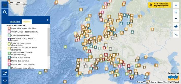
Speaking of science and communication, did you know that there is a map on marine installations in the European Atlas of the Seas? Explore the Map of the Week to discover the wide range of facilities in Europe, including research vessels. Click on the map to see the key characteristics for each facility!
Wish to learn more about educational initiatives related to the ocean and ocean literacy?
- Have a look at the 2022 CommOcean conference presentation on the European Atlas of the Seas;
- Discover the ‘Adopt a float’ project;
- Explore the European Global Ocean Observing System (EuroGOOS) educational resources;
- Stay tuned for upcoming news on the new My Maps function in the European Atlas of the Seas!
The data in the map are provided by EurOcean.

