Experts across the world are working together to get a better understanding of the ocean by sharing ocean data. In this framework, an online training on ‘Implementing the Ocean Data and Information System (ODIS) architecture’ organised by the Intergovernmental Oceanographic Commission (IOC) Ocean InfoHub (OIH) is taking place on 17-21 April 2023 and 24-28 April 2023. ODIS allows stakeholders to reliably share and discover key ocean data. It is developed by the International Oceanographic Data Exchange (IODE) of IOC-UNESCO together with their regional partners across the globe. Participants in the training will learn how to link their data systems into ODIS.
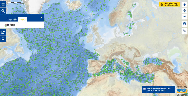
Speaking of data, did you know that oceanographic data can be collected using various instruments? One of the most common oceanographic instruments is the Argo float. Argo is an international programme which includes a global array of 3,800 free-drifting profiling floats that collect sub-surface environmental ocean data, including measurements of the temperature, salinity, current velocity (speed) as well as some other properties that reflect the biology or chemistry status of the upper 2,000 m of the ocean. The Argo floats are automated. They drift with the ocean currents and move up and down between the surface and a mid-water level. [1] At every 10-day interval, when the floats emerge from the ocean surface, data are transmitted via satellite and made publicly available within a few hours after collection. The latest locations of the floats are also being tracked to reveal sub-surface ocean current flow conditions. Explore the Map of the Week to see more details on each float, such as its current coordinates, types of measurements recorded, as well as near real-time data. This information can be accessed by clicking on the float symbol on the interactive map. In 20 years, Argo ocean floats have achieved 2 million ocean profiles. The data are revolutionising our knowledge of ocean dynamics and heat content. Data are also assimilated in near real-time into operational computer models to produce short-term predictions of currents (e.g., for offshore oil spills, search and rescue) and temperature (e.g., for fisheries), seasonal-to-interannual forecasting (e.g., El Niño), and for longer-term decadal predictions of the ocean/atmosphere climate system, such as those of the Intergovernmental Panel on Climate Change (IPCC).
Taking the advantage of the development of global Geographic Information System (GIS) and communication advancement, teachers in various disciplines, including, for example, science, geography, oceanography, environmental science and technology, are encouraging students to experience actual scientific observation programmes. The multidisciplinary educational programme ‘Adopt a Float’ makes it possible for students to monitor an Argo float and its data, to learn about the importance of ocean research, and to connect with ocean scientists! In the Miniboat program students build, launch, track and monitor a miniboat, allowing them to learn about ocean currents and weather as well as design and technology!
The data in this map are provided in near real-time by EMODnet.

