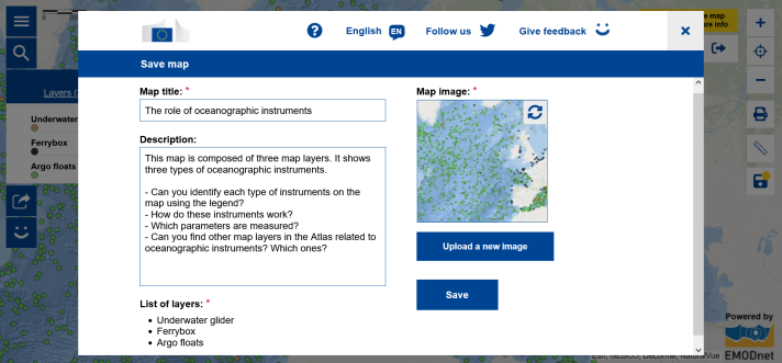
With the new My Maps function, you can easily integrate the European Atlas of the Seas in your work and customise maps to your needs.
- Do you want to prepare a lesson using a specific map?
- Do you want to select a combination of map layers to challenge your students?
- Do you want to share a map with your students?
The European Atlas of the Seas now allows you to save and reuse your maps! To access My Maps, click on the magnifying glass and select My Maps in the search window.
Your Atlas will let you:
- Save your selection of map layers
- Add your title to your map
- Generate a nice thumbnail or replace it by a picture
- Add your description of the map
Your opinion counts for us! We are looking for motivated teachers to test the My Maps function of the European Atlas of the Seas during the pilot phase. Provide us with your feedback and ideas so that we can further improve My Maps and make it an easy-to-use tool for your lessons! It is free to use and accessible to all. Create your EU login and get started!
Complete the survey to submit your feedback.
Do you have any questions on how to use the My Maps function? Check out the Atlas’ interactive help tool or contact us via the feedback form accessible from the Atlas’ menu!

