Will you be taking part in World Water Week next week? World Water Week is the leading conference on global water issues. Held every year since 1991, this non-profit event attracts a diverse mix of participants from many professional backgrounds and every corner of the world. [1] The conference will take place in Stockholm (Sweden) on 25-29 August 2024. World Water Week 2024 is centered on water cooperation, for peace and security in its broadest sense. The theme, Bridging Borders: Water for a Peaceful and Sustainable Future, asks us to recognise the regional and global interconnectivity of communities and nations, and underscores the collaborative effort needed to achieve a peaceful and sustainable future. [2] Explore the conference programme to discover the wide diversity of topics addressed over the five days of the conference. Are you very interested in learning about these topics but not going to Stockholm? Good news! You can register free of charge to attend the conference online!
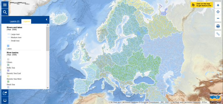
Speaking of water, did you know that the European Atlas of the Seas includes map layers on rivers and lakes as well as river basins? We have selected both map layers to create this week’s Map of the Week. Explore the resulting map to learn about rivers in Europe and river drainage basins, grouped according to the sea into which the water drains. Drainage networks and associated drainage basins form complex functional entities that are important not only for hydrological processes but also for environmental processes at large. Zoom in the map to see the names of the river.
Wish to learn more?
- Read the latest updates on World Water Week;
- Find out about the European #WaterWiseEU campaign to see water differently;
- Dive into the Freshwater Information System for Europe (WISE-Freshwater) to find information and data on the state of Europe’s rivers, lakes, groundwaters, on the pressures affecting them, on the measures and actions taken to protect and conserve the aquatic environment;
- Dive into the Marine Water Information System for Europe (WISE Marine) to access to data and information on the state of and pressures on Europe’s seas, and on actions that can be taken to protect and conserve them;
- Learn how the water cycle connects us all;
- Explore the UN-Water SDG 6 Data Portal.
Enjoy World Water Week!
The data in this map are provided by the Joint Research Center.