The European Atlas of the Seas can be used for students to explore and learn about the seas and maritime areas of the European Union in an interactive way. You can zoom in on a special area, sea basin or country, export the result to a link (to use it later) or even print it. If you are working with a website, you can embed a map easily (the code can be generated from the share option).
Moreover, you can play with transparency to enhance the details you want on your map, or change the background by selecting another base map. A measurement tool is available to calculate distances and areas. All this and more is explained under 'Do you need help?" in the Atlas' menu. Do not hesitate to contact us with your questions and feedback under 'Give feedback' in the Atlas' menu.
Click on the titles below to see the exercises.
Erosion |
Environment |
Security |
Maritime Spatial Planning |
Employment |
Algae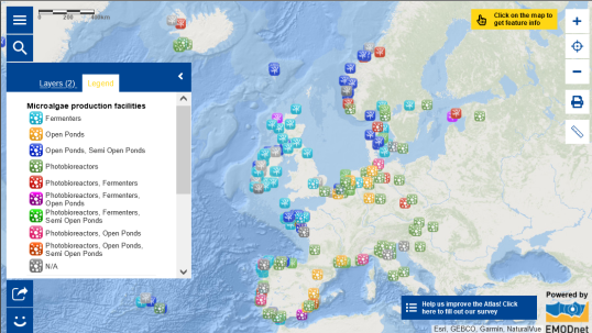
|
Posidonia oceanica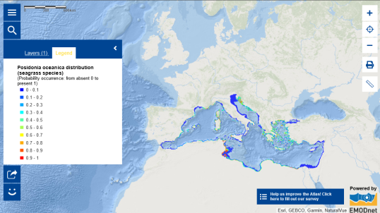
|
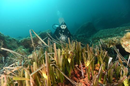 Documenting a Posidonia flowering event in Tavolara MPA- October 2022 Photo credits: Stefano Cellini |